


One year ago, Congress defunded public media. Now that we're 100% community funded, please become a sustaining member or increase your existing membership today.
Map: How big are the LA fires? Use this tool to overlay them atop where you live

Firefighters work to put out a fire in the rubble of a home that burned down on Pacific Coast Highway near Malibu, as a result of the Palisades Fire. Jan. 9, 2025.
(
Ted Soqui
/
CalMatters
)
The fires sweeping across Los Angeles County for the past week have burned more than 40,000 acres, an area roughly equivalent to 1,800 Alcatraz Islands or 400 Disneylands, or slightly larger than Washington, D.C.
An arid fall and winter have dried out vegetation after two wetter-than-average years, providing fuel as a windstorm, with hurricane-force gusts topping 100 mph, swept across the region. Wind-whipped flames spread rapidly throughout much of the county.
The Palisades Fire, which burned through Pacific Palisades and parts of Malibu, and the Eaton Fire, which burned Altadena and other foothill communities, have damaged or destroyed an estimated 12,000 houses and other structures. At least 24 people have died, making 2025 one of the deadliest and most destructive years on record less than two weeks after the year started.
-
 The heatwave is expected to last through the end of the month, with dangerous temperatures and beach conditions in the forecast.
 -
 While a late July heatwave baking Los Angeles is expected to break by Monday, a new heatwave could be following close behind next week.
 -
 As Los Angeles deals with fire season and high levels of pollution, LADWP customers can get an air purifier shipped to your home for the price of sale tax.


Two other fires in the area — the Kenneth Fire near Hidden Hills and the Hurst Fire in the San Fernando Valley — have largely been contained, according to CalFire.
It’s difficult to visualize how dramatically Los Angeles — California’s largest city in both physical size and population — has been affected. But to get a sense of the scope, you can enter a California address into the tool below to compare the fire perimeters to any area statewide.
For Apple News readers, you can explore the tool here.
Sponsored message
Check out the map
Do you have a question about the wildfires or fire recovery?
Check out LAist.com/FireFAQs to see if your question has already been answered. If not, submit your questions here, and we’ll do our best to get you an answer.
_
Fire resources and tips
If you have to evacuate:
- Why fire officials don't want you to stay and defend your home
- How to get packed up
- How to leave your house
- What evacuation terms mean and how to sign up for alerts
Navigating fire conditions:
- How to drive in high winds and fire danger
- How to prep for power outages
- How to navigate poor air quality
How to help yourself and others:
- Resources for fire victims, evacuees and first responders
- If you want to help fire victims, resist the urge to volunteer
- How to help find lost pets
How to start the recovery process:
- What to do — and not do — when you get home after a wildfire
- How to make an insurance claim
- How to safely clean up wildfire ash
What to do for your kids:
- How to talk to children about wildfires and losing a home
- What parents should know about wildfire air quality
Prepare for the next disaster:
Trending on LAist
-
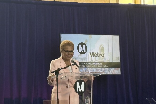 LA Mayor Bass previews ‘fare-free’ system as she takes the Metro Board chair gavel for a second timeAt the annual Metro State of the Agency event, Bass named system safety, affordability and reliability as her main priorities.
 -
 The city of L.A. has scheduled a hearing to gather testimony from residents and consider revoking an oil company’s permit to operate a facility in Jefferson Park.
 -
 Tickets from the Sept. 22 grand opening through the end of next February were up for grabs as of Tuesday.
 -
 Populations of two disease-carrying mosquito species are concerning public health officials, who are employing new strategies to reduce their populations.
 -
 The inaugural event kicks off Friday, July 24. The crawl includes stores from Pasadena to Santa Monica, from Montrose to Manhattan Beach.
 -
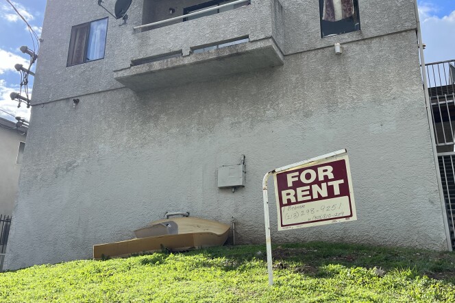 Recent rulings have struck down requirements in L.A. and Pasadena for landlords to pay thousands of dollars to tenants who couldn’t afford large rent hikes.


Best of LAist


