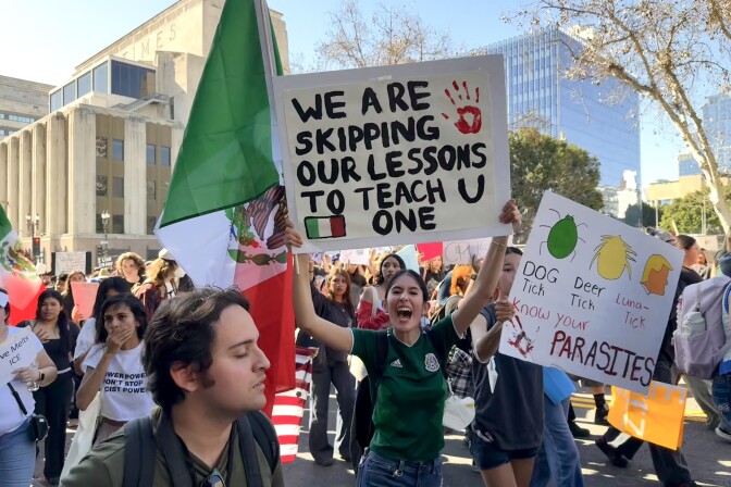
Thousands of Southern California students have walked out of school to protest the Trump administration’s crackdown on immigrants since January after the killings of Renee Good and Alex Pretti by federal agents in Minneapolis.
Some students have told LAist their teachers and principals supported their participation in the walkouts, for example, by allowing them to make protest signs in class. Others said their administrators shared confusing messages about potential discipline for leaving campus.
Broadly speaking, California law requires minors to attend school, but it also protects students’ rights to speak out.
”The fact that some students may have a controversial point of view that might make others upset, that's not a basis to restrict the speech under the education code,” said Peter Eliasberg, chief council with ACLU of Southern California.
LAist cannot offer legal counsel but created this guide to help students, families and educators better understand these rights. It’s based on:
- Information from Eliasberg and the ACLU of Southern California.
- A February webinar hosted by Compton nonprofit Community Lawyers Inc., with the Law Offices of Hirji, Chau and Rodriguez.
Tl;dr of best practices for students at protests
When preparing to walk out, you might consider the following:
- Have a clear civic and political purpose.
- Walk out peacefully. Do not create additional disruptions for other students, vandalize school property or physically harm others.
- Document the purpose of the walkout in writing but be cautious about recording video of participants who may not want to be identified.
- Ask your principal for school and district policies related to student walkouts and free speech and compare them to district policy and state laws.
- Request an excused absence for civic and political event (more on how to do this below).
An overview of the (many) rules
The rules at your school are likely shaped by a larger organization, such as a school district or a charter network. Beyond that is California’s education code, a part of state law that is dedicated to schools.
Apart from that, you have federal policy, like the U.S. Constitution, which guarantees the First Amendment right to freedom of speech.
Ideally, all of these sets of rules should agree with one another, but that’s not always the case, said Rosa Hirji, an educational, civil and disability rights attorney. Hirji said the information shared by school administrators also may not align with the policy of their school, district or California’s education law.
“You need to do your research and identify all of those things that you can do to protect yourself after the fact,” Hirji said. “Make sure that you disseminate that information amongst your peers and friends.”
California’s education code states students have the right to exercise freedom of speech and press, including by:
- Distributing printed materials
- Wearing buttons, badges or other symbols
- Expressing themselves in school publications
Hirji said schools cannot legally prevent students from expressing themselves, but they can make rules for when, how and where that free expression can occur. For example, a school may designate time at lunch for students to march and hold up signs with political messages.
But there are no protections for speech that incites students to create a “clear and present danger” of:
- Committing unlawful acts on campus
- Violating lawful school regulations
- Disrupting the operation of the school
Does calling for a walkout constitute inciting students to break rules? Not necessarily, Hirji said.
“ The question is — is that advocacy or calling for the walkout so inflammatory that it provokes some kind of disturbance in the school environment?” Hirji said. What qualifies as a “disturbance” is must be defined in policy and is not simply the opinion of the administrator, she added.
Speech that is obscene, libelous or slanderous is not protected.
How can I get an excused absence for walking out?
There are limited circumstances when schools will grant a student an excused absence to participate in a walkout, even when parents are supportive of the action.
California allows middle and high school students one excused absence per school year for a civic or political event. Students must notify the school in advance of the absence. School administrators may grant more than one excused absence related to protests, but they are not required to do so.
Community Lawyers Inc. created a template for this notice that students can print and fill out.
Can I get suspended or expelled for walking out?
Students can't be suspended or expelled solely for walking out, but students can be marked tardy, truant or absent. Multiple incidents may lead to more severe discipline.
Let’s define these terms:
- Tardy means a student has arrived late to class.
- Absent means a student is not present in class.
- Truant means a student has missed more than 30 minutes of instruction without an excuse three or more times during the school year.
Eliasberg said that missing class to attend a protest can’t be punished differently than any other kind of absence.
“The government can't say, 'Well, we think it's worse for you to go out and protest than it is for you to skip class,'” he said.
Truancy, tardiness or absence from school is not a basis for school suspension under California’s education code.
“So if a school district wants to engage in a disciplinary action against a student that walks out, they need to find another reason, another behavior that has occurred,” Hirji said.
For example:
- Causing, attempting or threatening physical injury or violence
- Possessing weapons or drugs
- Stealing or damaging school property
- Bullying, intimidating or sexual harassment
California passed a law in 2023 that prohibits schools from suspending middle and high school students for “willful defiance,” which includes disrupting school activities or defying school personnel.
But there can be consequences for walking out
Once a student is considered truant, the school district is required to notify the student’s family, provide information about alternative educational programs, available mental health support and the right to meet with school staff to discuss the student's absences from school.
The penalties for truancy can escalate the more often a student is absent and may include:
- Attending makeup classes
- Referral to an attendance review board, a group of people whose goal it is to help get students back in school
- Community service
More student free speech rights resources
What should I do if I get in trouble for walking out?
Before a student can be suspended, they must be informed of the reason for the suspension and whether other means of correction were attempted, Hirji said. Examples of those other forms of correction include additional school, community service or communicating with a parent.
”School is not supposed to suspend you on your first offense,” Hirji said.
Hirji said the school should provide evidence of the offense allegedly committed and allow students to provide their version of events. This is due process.
Students may be able to appeal a suspension, which means asking the school to reconsider the punishment.
Where can I find my school district or charter network’s policy?
Here are examples of documents a school or district may have related to students' free speech and protest rights.
School board policies and administrative regulations
- What they are: rules approved by a school district’s elected board
- Where to find them: your local school board’s website
School safety plan
However, schools and districts may have outdated policies that do not comply with existing law.
Hirji suggests comparing what a teacher, principal or other administrator says with the school, district and state’s rules.
Can the police get involved?
In mid-February, the Los Angeles Police Department warned that protesting students may face legal consequences for violating a city law that bars minors from public places during school hours.
The city of L.A.’s daytime curfew law states it is unlawful for minors under 18 to be in public places when they would normally attend school. There are several exceptions, including for emergencies and minors accompanied by a parent or guardian.
At one point, LAPD was issuing thousands of tickets a year during curfew sweeps, but the agency agreed in 2011 to ease enforcement after pushback from civil rights attorneys, parents and community activists.
Hirji said students who have excused absences for civil and political reasons should not be subject to the daytime curfew law and suggests protesting students carry proof of their excused absence with them — for example, a copy of the letter or email provided to the school to excuse the absence.


