This story is free to read because readers choose to support LAist. If you find value in independent local reporting, make a donation to power our newsroom today.
This archival content was originally written for and published on KPCC.org. Keep in mind that links and images may no longer work — and references may be outdated.
Ughhh, it’s 100+ degrees in SoCal. Here’s why
If you had to describe typical fall weather, you might use words like "crisp," "refreshing" and "enjoyable." But if you're in Southern California this week, you may find the words "windy," "dry" and "hellish" to be more apt.
Even though November's right around the corner, this week temperatures are expected to approach or top 100 degrees across Los Angeles, Ventura and Orange counties.
#DTLA's average high temperature on October 23 is 77.8 °F.
— DTLA Daily High (@DTLAdailyhigh) October 23, 2017
The forecast for today is 102 °. That's way above normal. #LAweather
"These are temperatures that typically do not occur this time of year," said Mark Jackson, the head meteorologist at the National Weather Service for Los Angeles. But they're not unprecedented. Actually, they're the result of recognizable atmospheric patterns.
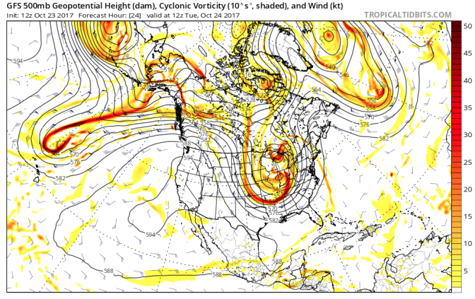
Right now, there's a high pressure system sitting over nearly the entire western U.S. It's acting like a dome, trapping in heat, pushing away cooler, low pressure systems from flowing in from the Pacific.

And, as any seasoned Southern Californian might guess, the Santa Ana winds are also involved.
The high pressure system is pushing down on the open, arid and hot Great Basin – the area of land east of the Sierra Nevadas and west of the Rocky Mountains. The wind from that high pressure area flows towards lower pressure areas in the Southwest, including the California Coast. And as the wind travels over the mountains and down into the Los Angeles basin, it's compressed, warmed up and dried out. Creating miserable fall weather, but perfect fire weather.
Those winds and high pressure systems are also pushing back cool winds that usually comes in from off the coast.
"Our mediterranean climate is very much controlled by the temperature of the ocean," said Jackson. "If we get wind that can blow from the ocean to the land, it's like a natural air conditioner." said Jackson.
Our natural air conditioner is temporarily out of order.
These types of high pressure systems typically last a few days, said Jackson. This one's expected to break up between Thursday and Saturday. After that, temperatures will start to fall and humidity will rise, as ocean air blows onto land once more.
However, it might still be too early for adjectives like "crisp" and "cool" to describe the weather. Jackson said that temperatures in the short-term are still expected to be above normal for this time of year.


