


One year ago, Congress defunded public media. Now that we're 100% community funded, please become a sustaining member or increase your existing membership today.
As California debates Zone Zero, researchers want to know: Can trees protect homes from fire?


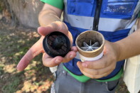
UCLA's Edith de Guzman explains a pattern her research team has noticed: trees that appear to have been burned by nearby structures rather than spreading flames to those structures.
(
Erin Stone
/
LAist
)
Listen
3:44
What we can learn about fire from trees
As California debates Zone Zero, researchers are studying whether trees can protect homes from fire.
On a recent spring morning in Pacific Palisades, the clanging and hammering of construction filled the air. A small group of people gathered under a partially burnt Brisbane box tree shading the sidewalk on a street near the center of town.
The group took measurements — the leafiness of its crown, the width of its trunk. They inspected its bark for fungus and noted any new growth sprouting.
For more than a year, a group of researchers and students from UCLA, UC Davis, University of Florida and the U.S. Forest Service, alongside local volunteers and students, have collected data on more than 2,000 trees — about 600 in the Palisades and 1,500 in Altadena — to analyze how they may recover after the fires and their role in the fires’ spread.
The question about the fires' spread is key as California debates new regulations, called Zone Zero, near homes in high-risk fire areas. Their ongoing research is showing that in some cases, well-maintained vegetation may actually help buildings survive a fire.
The data will be some of the most extensive ever gathered to understand how the urban tree canopy fares in the face of increasingly catastrophic fires in an era of human-caused climate change.
You can weigh in on Zone Zero
What: Southern California Zone Zero workshop. The California Board of Forestry and Fire Protection is drafting regulations about how to reduce wildfire risks to homes. It is holding meetings around the state and soliciting the public's input.
When: Today (April 23), 1 to 7 p.m.
Where: In person at Calabasas Community Center, the Grove Room, 2740 Malibu Hills Road, Calabasas
Online: The meeting agenda and how to register to attend virtually are here.
How to submit public comment: Email PublicComments@bof.ca.gov.
More details: Read the summary sheet and draft rule. Track upcoming meetings.
Monitoring the health of post-fire trees
The team of researchers has been collecting data on trees in the Eaton and Palisades burn scars since just a few days after the fires started last year.
They’ve primarily focused on trees in the public right-of-way in areas with the highest number of tree species — that way they’ll be able to compare their data with tree canopy data from before the fires. The researchers have used in-person monitoring and remote sensing to survey the areas. A team from UC Davis has been collecting data using LiDAR.
Sponsored message
“The purpose of our work is essentially to see how the trees have done,” said Edith de Guzman, a cooperative extension specialist with the UCLA Luskin Center for Innovation. “We want to understand how different species or different tree types fare. And another aspect of the study is around flammability of trees and essentially doing a little bit of forensic work to understand what burnt what.”

Edith de Guzman (left) assists an undergraduate student measuring a fire-scarred tree in Pacific Palisades.
(
Erin Stone
/
LAist
)
The group stops at a jacaranda tree a little further up the street from the Brisbane box. Part of the crown is blooming purple, but fungus grows on its trunk.
“It's flowering, which is good. It's demonstrating that it still has enough energy to do that,” de Guzman said. “But we really don't see any growth that's happening from the fine branches and fine twigs at the end. So this tree's not doing super well.”
The bark is blackened on the side of the trunk closer to where a house once stood. The bark on the street side is lighter — some sprouts reach out from the trunk.
It’s a common pattern, de Guzman said.
“ The pattern that we see again and again is that the tree caught fire from the structure rather than the other way around,” she said.
Sponsored message
" The pattern that we see again and again is that the tree caught fire from the structure rather than the other way around."
— Edith de Guzman, UCLA tree researcher
Though they’ve only done preliminary analysis, de Guzman said that so far, they’re finding mature trees, no matter the species, tended to survive the flames better. And that most of the surviving trees they’ve surveyed actually grew in the last year.
“We are seeing that by and large, many trees are coming back and we just need to give them a chance,” said de Guzman. “They might be a little unsightly, they might not look exactly like they did before the fires, but they want to live, most of them. And we have quite a lot of species, both native and non-native, that are coming back.”
-
 Populations of two disease-carrying mosquito species are concerning public health officials, who are employing new strategies to reduce their populations.
 -
 The inaugural event kicks off Friday, July 24. The crawl includes stores from Pasadena to Santa Monica, from Montrose to Manhattan Beach.
 -
 Recent rulings have struck down requirements in L.A. and Pasadena for landlords to pay thousands of dollars to tenants who couldn’t afford large rent hikes.


What the research says so far
Most research on wildfires, tree canopy and fire spread has come from rural, forested areas, said Francisco Escobedo, a research scientist with the Forest Service who has studied the issue for more than six years in areas such as Santa Rosa and Paradise.
“When we have these urbanized, highly populated, densely built environments that are affected by fire, we know very little about what happens to trees,” Escobedo said. “A lot of these trees, unlike the trees we have in our surrounding forests, didn't evolve with fires. What happens to jacarandas, what happens to magnolias, what happens to coast live oaks in urban environments?”
Sponsored message

A tree in Pacific Palisades that appears to have suffered the most on the side where a house once stood.
(
Erin Stone
/
LAist
)
His research in more urban areas affected by fire is painting an increasingly nuanced picture. One recent study remotely measured some 16,000 buildings, as well as surrounding vegetation moisture, in Paradise in Northern California after the 2018 Camp Fire and Ventura after the 2017 Thomas fire. They found that drier vegetation near buildings in both areas was associated with building loss. But in Ventura, buildings near trees that were not water-stressed actually had a better chance of survival.
“ So the greener the trees were, the higher the influence of that vegetation on the building surviving,” Escobedo said.
The reasoning is still being parsed out, but Escobedo said they suspect it’s in part due to variations in types of vegetation and how the fires spread in each area. In both areas, embers largely drove building-to-building fire spread, though the intensity of the fire front and the nature of the vegetation were different — largely conifer forest up north, versus chaparral, shrub greenery here in Southern California.

While houses burned around them, many trees were able to withstand the flames, as shown by this aerial view of Altadena from June 2025.
(
Myung J. Chun
/
Getty Images
)
Escobedo says that’s why hardening homes and location-specific vegetation recommendations are key, rather than blanket policy recommendations. He added that the latest iteration of Zone Zero proposed regulations embraces more of this nuance.
“These neighborhoods are just very different from wildland conditions,” Escobedo said. “This home ignition zone, defensible space buffer concept we have was developed in wildland areas.”
Sponsored message
“ If vegetation gets dry enough, hot enough, it's going to burn,” he added. “From what we've learned with home-hardening practices, there are things you can do to your home to reduce that ignitability. So what we think our research might be leading to is that there are things you can do with your vegetation to reduce that probability of ignition.”
Another aspect of the research will focus on how different species of trees responded to the fires, which will provide another helpful data point for policies and insurance protections, said Alessandro Ossola, an associate professor in urban plant science at UC Davis, who has led the LiDAR sensing aspect of the data collection.
“ We can plant, strategically, trees of the right species to withstand climate change but still provide benefits to the community and people that need trees so much,” he said.

Many trees in burn scar areas are resprouting in unusual ways, like this one in Pacific Palisades. The odd growth patterns can be a sign of stress and recovery.
(
Erin Stone
/
LAist
)
A symbol of resilience, data to inform policy
The researchers also hope their work will inform better protections for urban forests before and after future fires. For many survivors of the Eaton and Palisades fires, the loss of their neighborhood trees since debris removal and, lately, ongoing construction has been yet another gut punch on top of the loss of their communities.
Already about 20% of their survey trees have been cut down since last year’s fires, de Guzman said. And as summer heat arrives, many of the remaining surviving trees will need help to make it through.
“What we're seeing is that removals are happening illegally,” she said. “ There are removals that are happening potentially by developers or their contractors despite the fact that the tree is not a high-risk tree and despite the fact that the tree is trying to bounce back.
“ So a lot of the trees should just be monitored at this point, not removed.”
Another recent Forest Service study found that the urban tree canopy recovered to pre-fire levels in Ventura and Santa Rosa within five years. However, the forest canopy declined overall in forested areas near Paradise — another indication of how different ecosystems respond in different ways to fire.

UCLA graduate student Matthew Murphy measures growth on the crown of a tree.
(
Erin Stone
/
LAist
)
“How can we ensure that we can continue to live with nature in ways that are protective, both of our built environment and of the softer, greener things that make it livable and inviting?” said de Guzman.
While many questions remain, in many ways, the research is not just rooted in the physical realm, she said.
“These trees were witnesses to an inferno — some firefighters tell that temperatures reached 2,000 degrees and more — and yet here they are,” de Guzman said. “These neighborhoods are going to change completely. … But we have an opportunity to maintain some of the witnesses that are here to tell the story of the before times.”

Senior Vice President News, Editor in Chief


