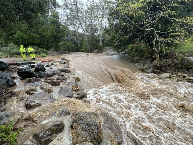
Another atmospheric river is now drenching Southern California. This particular river in the sky is ranked 2 to 3 on as scale that goes up to 5 ... but what does that ranking mean and why do we have it?
And, as the climate crisis drives increasingly extreme weather, communicating just how extreme that weather actually is can also be challenging. From extreme heat to atmospheric rivers, weather hazard scales are no longer just for hurricanes and tornadoes.
A scale for atmospheric rivers?
After the last major drought came to an end in 2016, an intense February atmospheric river punched a hole in Oroville Dam, forcing more than 180,000 people downstream to evacuate. Then, in March 2017, melting snowpack and warm rains threatened to flood the Owens Valley.
Those disasters prompted the development of the Atmospheric River Scale Forecast, which was developed by researchers at UC San Diego’s Center for Western Weather and Water Extremes, in partnership with the National Weather Service and the U.S. Geological Service. It was released in 2019.
When it comes to extreme heat, last year California became the first state in the nation to pass a law to start ranking heat waves. The state’s Environmental Protection Agency has until January 2025 to come up with the system.
How does the scale work?
It ranks atmospheric rivers on a scale of 1 to 5, similar to hurricane and tornado rankings, and is used by the National Weather Service’s offices to help determine how it communicates local risks. It also helps state water managers decide how much water may need to be released from dams.
The Atmospheric River Scale
• AR 1 (Weak): Primarily beneficial. For example, a Feb. 2, 2017 AR hit California, lasted 24 hours at the coast, and produced modest rainfall.
• AR 2 (Moderate): Mostly beneficial, but also somewhat hazardous. An atmospheric river on Nov. 19-20, 2016 hit Northern California, lasted 42 hours at the coast, and produced several inches of rain that helped replenish low reservoirs after a drought.
• AR 3 (Strong): Balance of beneficial and hazardous. An atmospheric river on Oct. 14-15, 2016 lasted 36 hours at the coast, produced 5-10 inches of rain that helped refill reservoirs after a drought, but also caused some rivers to rise to just below flood stage.
• AR 4 (Extreme): Mostly hazardous, but also beneficial. For example, an atmospheric river on Jan. 8-9, 2017 that persisted for 36 hours produced up to 14 inches of rain in the Sierra Nevada and caused at least a dozen rivers to reach flood stage.
• AR 5 (Exceptional): Primarily hazardous. For example, a Dec. 29 1996 to Jan. 2, 1997 atmospheric river lasted over 100 hours at the Central California coast. The associated heavy precipitation and runoff caused more than $1 billion in damages.
“Not every storm that hits the West Coast is an atmospheric river and not all atmospheric rivers themselves are the same,” said Jay Cordeira, the Atmospheric Science and Applications Manager at UCSD’s Center for Western Weather and Water Extremes, part of the Scripps Institution of Oceanography. Cordeira helped develop the scale.
“Some may be very beneficial, filling up reservoirs, helping to alleviate drought. But there are categories of atmospheric rivers, which can be particularly hazardous and produce flooding, debris flows, landslides and challenge water resources,” he said.
DWR continues to release water from Oroville Dam to the Feather River for #flood control protection to downstream communities. Releases from the main spillway were increased to 15,200 cubic ft per second this morning, which accounts for all current releases to the Feather River. pic.twitter.com/EyimmwE5NM
— CA - DWR (@CA_DWR) March 13, 2023
A changing water cycle
It sounds counterintuitive, but atmospheric rivers are expected to become more intense as carbon pollution increases global temperatures and brings less snowpack and more rain.
Climate change and the water cycle
Maybe you remember the concept of the water cycle from elementary school: when water from lakes, rivers and the ocean evaporates, it condenses to form clouds, then falls back to the earth in the form of rain or snow.
But as our climate heats up, more water on the landscape evaporates. That leaves less water for humans and the animals and plants that rely on that surface water, and also leads to a “thirstier” atmosphere, which then dumps that evaporated water in the form of increasingly intense storms or atmospheric rivers.
That’s why the climate crisis is making California’s drought-to-deluge cycle even more extreme and less predictable.
“As we go into a warming climate and we expect atmospheric rivers to potentially be stronger or last longer,” Cordeira continued, “the scale can hopefully do a great job at communicating those hazards for years to come.”
It’ll likely be a while before we start hearing this scale regularly since that’ll require a regional agreement by the National Weather Service, said Alex Tardy, a meteorologist with the NWS.
“We're working in that direction so that it's similar to like tropical weather where we say ‘It's a Category 4,’” Tardy said.
The ongoing challenge, Tardy said, is conveying danger as our weather norms shift and the public deals with disaster fatigue.
You can read more about the atmospheric river scale here.


