This story is free to read because readers choose to support LAist. If you find value in independent local reporting, make a donation to power our newsroom today.
This archival content was originally written for and published on KPCC.org. Keep in mind that links and images may no longer work — and references may be outdated.
A bigger chance of El Niño returning in 2014, but with little rain

El Niño can’t seem to make up its mind. After climatologists had previously stated that the chances of the warming weather phenomenon occurring this winter were becoming ever slimmer, it seems that there may now be a “glimmer of hope for a very modest comeback,” according to a press release from NASA’s Jet Propulsion Laboratory.
Ocean temperatures in equatorial Pacific had been rising earlier this year — indicating El Niño conditions. But they fell over the summer — dashing hopes for much needed rain.
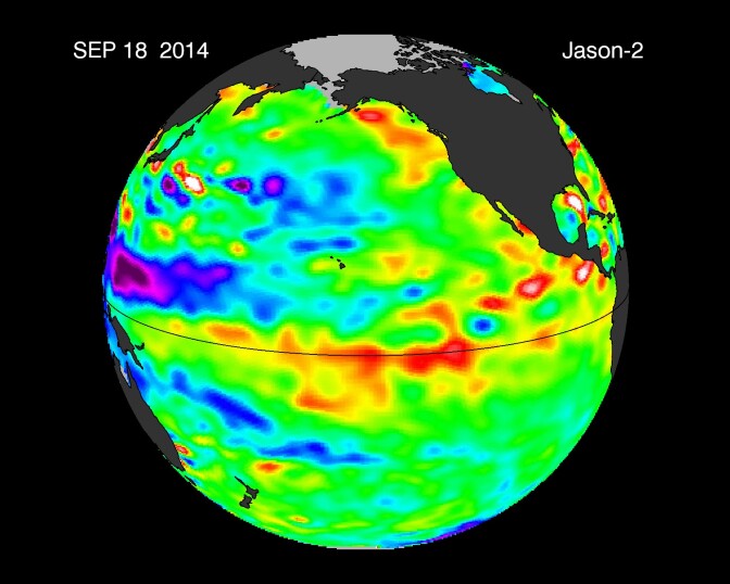
Satellite images now show that warmer eastward “Kelvin waves” are headed towards the South American coast in the next two months, indicating a resurgent El Niño weather pattern. However, if El Niño triggers a wetter winter, it probably won't mean drought-busting rain.
“If I was to compare where we are at with El Niño with where we were in ‘97-‘98, which was the Godzilla El Niño, I would call this one the gecko El Niño,” JPL climatologist Bill Patzert tells KPCC. He says El Niños can be small and modest and have little to no impact whatsoever on our rainfall.
NASA scientists will continue to monitor the Pacific for any changes.
Watch NASA video of El Niño forming earlier this year.


