


One year ago, Congress defunded public media. Now that we're 100% community funded, please become a sustaining member or increase your existing membership today.
Record breaking heatwave continues to bring more fire threat to the Southland


Don't put your AC units away just yet
(
Photo by Konstantin Sutyagin via Shutterstock
)
Quick Facts
- Today’s weather: Hot, sunny
- Beaches: 70s
- Mountains: 90s to 100
- Inland: 90s-100s
- Deserts: 100s - 110s
- Warnings and advisories: Excessive heat warning, Red flag warning
High heat continues across the Southland today and the threat of gusty winds could elevate fire conditions. Public health officials also say you might want to think twice about cooling off at some L.A. County beaches due to high levels of bacteria.

More high heat expected across the Southland today.
(
Courtesy NWS
)
Forecasters say yesterday's highs broke records for the month of October.
Record high temperatures were smashed today at several locations; check out this slide for more details. Tomorrow we expect similarly hot conditions, potentially even more records are likely to be smashed. Be safe during this #heatwave, don't get caught surprised! #CAwx pic.twitter.com/EIbKHgmfSD
— NWS Los Angeles (@NWSLosAngeles) October 2, 2024
-
 What do parents do when extreme heat and wildfire smoke increasingly make the outdoors dangerous?
 -
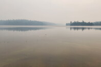
 California’s wildfires are destroying forests faster than the state can replant them, and federal cuts are making the gap worse.
 -
 The heatwave is expected to last through the end of the month, with dangerous temperatures and beach conditions in the forecast.


Hot at the coast, but stay away from the ocean
A heat advisory kicks in today at 10 a.m. for the inland coast — that means daytime highs will be in the upper 80s to the 90s. Temperatures at the beaches will be in the upper 70s with some patchy fog until 11 a.m.
L.A. County public health officials are warning Angelenos to stay away from these nine beaches due to high levels of bacteria:
- Windward storm drain at Venice Beach
100 yards up and down the coast from the storm drain. - Mothers Beach in Marina Del Rey
The entire swim area. - Walnut Creek at Paradise Cove
The entire swim area. - Marie Canyon Storm Drain at Puerco Beach
100 yards up and down the coast from the public access steps. - Inner Cabrillo Beach in San Pedro
The entire swim area. - Santa Monica Pier in Santa Monica
100 yards up and down the coast from the pier. - Topanga Canyon Beach in Malibu
100 yards up and down the coast from the lagoon. - Manhattan Beach Pier in Manhattan Beach
100 yards up and down the coast from the pier. - Las Flores Creek at Las Flores State Beach
100 yards up and down the coast from the creek.
High heat inland
More excessive heat for valleys and inland areas today where the daytime highs for Inland Empire, San Fernando Valley and Santa Clarita Valley could reach up to 109 degrees. Orange County inland areas will see highs in the mid 90s. And foothill communities will be hot, with highs around 100 degrees. Coachella Valley will see highs up to 114 degrees.
Sponsored message
In times of high heat, it's important to stay indoors, hydrated and cool. Make sure you know the difference between heat stroke vs. heat exhaustion.
Tonight's lows will provide some relief — down to the 70s for the warmest valleys, in the 60s closer to the coast. Desert lows will drop to the 80s.
Cooling centers
In response to the heat, the city of L.A. has activated five cooling centers today from 10 a.m. to 9 p.m.
- Fred Roberts
4700 S. Honduras Street LA 90011 - Jim Gilliam Recreation Center
4000 S. La Brea Avenue LA - Sunland Senior Center
8640 Fenwick Street, Sunland 91040 - Mid-Valley Senior Citizen Center
8825 Kester Avenue, Panorama City 91402 - Lincoln Heights Senior Center
2323 Workman Street, LA 90031
SoCal Cooling Centers
In L.A., Orange, San Bernardino, and Riverside counties, call 3-1-1 or call for a list of cooling centers. In the city of Los Angeles, you can also find a list of recreation centers, senior centers and libraries — all good choices for cooling off — online.
- Tip: Call the center in advance to make sure seating is available.
- Tip: If the center you want is at capacity, or non-operational, head to a local, air-conditioned library and cool off with a book about ice fishing in Antarctica.
You can get more details of cooling centers in Southern California:
Fire threat
Forecasters have issued a red flag warning for the I-5 and Highway 14 corridors including the Western San Gabriel mountains. High temperatures up to 106 degrees is possible and coupled with gusty winds up to 25 mph and low humidity could create the risk of wildfires. That warning is in effect until 8 p.m. Thursday.

Senior Vice President News, Editor in Chief


